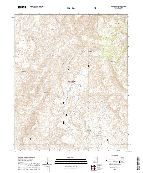
2021 Map of Armer Mountain
USGS Topo · Published 2021About this map
The high peaks and deep drainage systems of the Sierra Ancha dominate this portion of the Tonto National Forest in central Arizona. This mountainous landscape is defined by massive formations such as Tanner Peak, Armer Mtn, and the distinctive Dutchwoman Butte. Water management in this arid environment is evident through a network of tanks and springs, including Whiskey Tank, Dutchwoman Tank, and Hale Spring, which support the high-country range. The intricate topography is further marked by The Jug and the sheer walls of Hells Hole, where Workman Cr descends toward the Salome Cr basin. A series of forest trails, such as the Boyer Trl and Lost Goldmine Trl, traverse the ridges and canyons, providing the primary access routes through Boyer Canyon and across Thompson Mesa.
Find a feature on this map
61 named features on this map. Tap any name to fly to it.
Don’t see what you’re looking for? This feature index may not catch every label — zoom into the map to look around manually.
Map Details
Editions of this 2021 Armer Mountain Map
This is the sole edition of this map. No revisions or reprints were ever made.
Other maps of this area

1907 · Roosevelt
USGS Topo · 1:125,000

1909 · Four Peaks
USGS Topo · 1:125,000

1912 · Roosevelt
USGS Topo · 1:125,000

1922 · Chrysotile
USGS Topo · 1:125,000

1949 · McFadden Peak
USGS Topo · 1:62,500

1949 · Rockinstraw Mtn
USGS Topo · 1:62,500

1950 · Rockinstraw Mtn
USGS Topo · 1:62,500

1950 · McFadden Peak
USGS Topo · 1:62,500

1954 · Mesa
USGS Topo · 1:250,000

1957 · Mesa
USGS Topo · 1:250,000