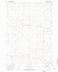
1952 Map of Arminto NW
USGS Topo · Published 1976About this map
High-plains ranching operations and steam-era rail infrastructure define this mid-century landscape in Natrona County. The Chicago Burlington and Quincy railroad cuts a prominent east-west path across the northern half of the quadrangle, following the gradual drainage of Alkali Creek. This corridor served as a vital transport link for the remote livestock operations that anchored the local economy, evidenced by scattered family holdings including Todd Ranch and Sullivan Ranch. In the southern reaches, the ephemeral drainage of Poison Creek and Garrison Draw cross the terrain near Jack Ranch and Wight Ranch. Several Windmill sites and a perennial Spring are noted, highlighting the essential water sources required to sustain life and industry in this arid Wyoming basin.
Find a feature on this map
11 named features on this map. Tap any name to fly to it.
Don’t see what you’re looking for? This feature index may not catch every label — zoom into the map to look around manually.
Map Details
Editions of this 1952 Arminto NW Map
2 editions found
Other maps of this area

1952 · Badwater
USGS Topo · 1:24,000

1952 · Arminto
USGS Topo · 1:24,000

1952 · Arminto SW
USGS Topo · 1:24,000

1952 · Madden
USGS Topo · 1:24,000

1952 · Arminto NW
USGS Topo · 1:24,000

1952 · Lysite SE
USGS Topo · 1:24,000

1952 · Moneta SE
USGS Topo · 1:24,000

1952 · Hiland
USGS Topo · 1:24,000

1952 · Badwater SE
USGS Topo · 1:24,000

1955 · Arminto
USGS Topo · 1:250,000