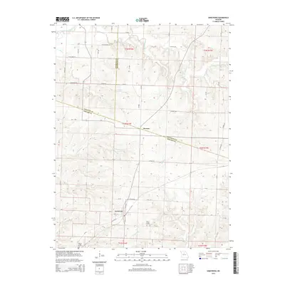
2014 Map of Armstrong
USGS Topo · Published 2014About this map
Armstrong serves as a primary hub in this central Missouri landscape where Howard, Randolph, and Chariton counties converge. The town's grid, including Snoddy St and Glasgow St, anchors a rural territory defined by a dense network of watercourses and county roads. To the northeast lies Roanoke, situated near the intersection of several county lines. The area is heavily dissected by the East Fork Little Chariton River and its numerous tributaries, including Silver Creek, Mott Cr, and Doxies Fork. Local history is preserved at sites like Wesley Chapel Cemetery and Walnut Ridge Cemetery, while Helmich Lake provides a notable point of interest among the winding creeks and agricultural tracts. This 2014 survey documents the enduring rural infrastructure of the region, from the path of Mo-V to the various gravel routes like Silver Crossing Rd and Switzer Mill Rd.
Find a feature on this map
44 named features on this map. Tap any name to fly to it.
Don’t see what you’re looking for? This feature index may not catch every label — zoom into the map to look around manually.
Map Details
Editions of this 2014 Armstrong Map
This is the sole edition of this map. No revisions or reprints were ever made.
Other maps of this area

1890 · Glasgow
USGS Topo · 1:125,000

1947 · Glasgow
USGS Topo · 1:62,500

1953 · Moberly
USGS Topo · 1:250,000

1953 · Fayette
USGS Topo · 1:24,000

1953 · Burton
USGS Topo · 1:24,000

1953 · Huntsville
USGS Topo · 1:24,000

1953 · Higbee
USGS Topo · 1:24,000

1953 · Armstrong
USGS Topo · 1:24,000

1953 · Clifton Hill
USGS Topo · 1:24,000

1954 · Moberly
USGS Topo · 1:250,000