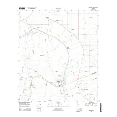
2015 Map of Arnaudville
USGS Topo · Published 2015About this map
Bayou Teche defines the local geography of this South Louisiana landscape, winding south through the center of Arnaudville and the community of Darby. The waterway is flanked by a complex network of bayous and drainage coulees, including Bayou Portage to the east and Coulee de Marks to the west. This 2015 survey shows a rural landscape where agricultural plots are partitioned by a grid of named local roads like Oscar Rivette Rd and Dalfrey Ln.
Find a feature on this map
119 named features on this map. Tap any name to fly to it.
Don’t see what you’re looking for? This feature index may not catch every label — zoom into the map to look around manually.
Map Details
Editions of this 2015 Arnaudville Map
This is the sole edition of this map. No revisions or reprints were ever made.
Other maps of this area

1939 · Opelousas
USGS Topo · 1:62,500

1940 · Arnaudville
USGS Topo · 1:62,500

1952 · Lake Charles
USGS Topo · 1:250,000

1954 · Lake Charles
USGS Topo · 1:250,000

1954 · Baton Rouge
USGS Topo · 1:250,000

1956 · Opelousas
USGS Topo · 1:62,500

1956 · Baton Rouge
USGS Topo · 1:250,000

1957 · Opelousas
USGS Topo · 1:62,500

1957 · Carencro
USGS Topo · 1:62,500

1959 · Palmetto
USGS Topo · 1:62,500