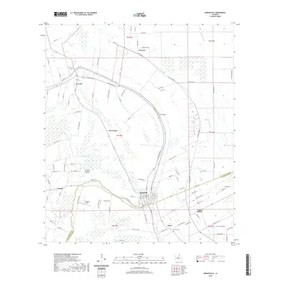
2020 Map of Arnaudville
USGS Topo · Published 2020About this map
Arnaudville and the surrounding Acadiana landscape are defined by the winding course of Bayou Teche, which serves as a natural boundary between St. Landry and St. Martin Parishes. This 2020 map documents a region where French-settled land patterns are still evident in the long, narrow lot divisions visible along the waterways. Community life centers on the established settlements of Leonville and Pecaniere, with historical continuity preserved at sites like Saint Francis Regis Catholic Cem and Saint Leo Cem.
Find a feature on this map
112 named features on this map. Tap any name to fly to it.
Don’t see what you’re looking for? This feature index may not catch every label — zoom into the map to look around manually.
Map Details
Editions of this 2020 Arnaudville Map
This is the sole edition of this map. No revisions or reprints were ever made.
Other maps of this area

1939 · Opelousas
USGS Topo · 1:62,500

1940 · Arnaudville
USGS Topo · 1:62,500

1952 · Lake Charles
USGS Topo · 1:250,000

1954 · Lake Charles
USGS Topo · 1:250,000

1954 · Baton Rouge
USGS Topo · 1:250,000

1956 · Opelousas
USGS Topo · 1:62,500

1956 · Baton Rouge
USGS Topo · 1:250,000

1957 · Opelousas
USGS Topo · 1:62,500

1957 · Carencro
USGS Topo · 1:62,500

1959 · Palmetto
USGS Topo · 1:62,500