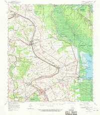
1963 Map of Arnaudville
USGS Topo · Published 1970About this map
Bayou Teche winds through the heart of Acadiana in the early 1960s, serving as the historical spine for settlements from Leonville down to Breaux Bridge. The landscape reveals the enduring footprint of the plantation era, preserved in the large land tracts of La Bourgeois Plantation and Magenta Plantation. To the east, the massive Atchafalaya Basin Floodway dominates the geography, a controlled wilderness of bayous like Bayou Chenevert and Bayou Fordoche designed to manage the river's power. Industrial development is evident in the Krotz Springs Oil and Gas Field and near Anse La Butte, where extraction sites sit alongside traditional rural life. The map meticulously records the spiritual and educational centers of these communities, including the Ring Zion Ch. & Cem. and the Cecelia Elem Sch, providing a clear view of the social fabric of St. Martin and St. Landry parishes during this period.
Find a feature on this map
91 named features on this map. Tap any name to fly to it.
Don’t see what you’re looking for? This feature index may not catch every label — zoom into the map to look around manually.
Map Details
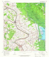
Editions of this 1963 Arnaudville Map
2 editions found
Other maps of this area

1935 · Osca Bayou
USGS Topo · 1:62,500

1939 · Opelousas
USGS Topo · 1:62,500

1939 · St. Martinsville
USGS Topo · 1:62,500

1939 · Fordoche
USGS Topo · 1:62,500

1940 · Arnaudville
USGS Topo · 1:62,500

1941 · Loreauville
USGS Topo · 1:62,500

1946 · Lafayette
USGS Topo · 1:31,680

1952 · Lake Charles
USGS Topo · 1:250,000

1954 · Lafayette
USGS Topo · 1:31,680

1954 · Loreauville
USGS Topo · 1:62,500