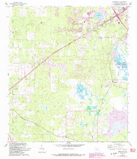
1966 Map of Arredondo
USGS Topo · Published 1993About this map
The Arredondo Grant Boundary provides a historic framework for this landscape southwest of Gainesville, where the Seaboard Coast Line Railroad cuts a diagonal path through the settlements of Arredondo and Kanapaha. This mid-century survey, later updated with suburban expansion in the 1990s, illustrates a transition from rural Florida into a more developed corridor. Family and community history is anchored by the Kanapaha Cem, Elim Ch, and Wesley Chapel, alongside local landmarks like the Gainesville Speedway and Stengel Airport.
Find a feature on this map
26 named features on this map. Tap any name to fly to it.
Don’t see what you’re looking for? This feature index may not catch every label — zoom into the map to look around manually.
Map Details
Editions of this 1966 Arredondo Map
3 editions found

Other maps of this area

1890 · Arredondo
USGS Topo · 1:62,500

1892 · Arredondo
USGS Topo · 1:62,500

1894 · Arredondo
USGS Topo · 1:62,500

1895 · Williston
USGS Topo · 1:62,500

1954 · Gainesville
USGS Topo · 1:250,000

1955 · Bronson NE
USGS Topo · 1:24,000

1958 · Gainesville
USGS Topo · 1:250,000

1959 · Gainesville
USGS Topo · 1:250,000
1966 · Micanopy
USGS Topo · 1:24,000

1966 · Gainesville West
USGS Topo · 1:24,000