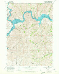
1969 Map of Arrowrock Dam
USGS Topo · Published 1972About this map
Arrowrock Dam anchors this 1969 topographic survey, where the Boise River forms the sprawling Arrowrock Reservoir within the Boise National Forest. This mapping reflects a mid-century landscape managed for water storage and recreational access, shown through the Spring/Shores Recreation Site and Macks Creek Recreation Site. The intricate topography reveals a complex network of drainages such as Sams Gulch and Browns Gulch, which cut through the steep elevations toward the river. To the southwest, the upper reaches of Lucky Peak Reservoir are visible, including the Lucky Peak River channel. Notable land features like Three Point Mountain and Highland Valley provide fixed points for understanding the area's relief. This sheet also records local boundaries between Ada, Boise, and Elmore counties, as well as more localized features like the Wood Creek Enclosure and numerous jeep trails navigating the backcountry.
Find a feature on this map
41 named features on this map. Tap any name to fly to it.
Don’t see what you’re looking for? This feature index may not catch every label — zoom into the map to look around manually.
Map Details
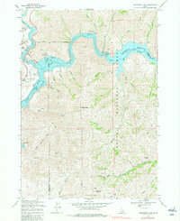
Editions of this 1969 Arrowrock Dam Map
2 editions found
Other maps of this area

1892 · Mountain Home
USGS Topo · 1:125,000

1892 · Boise
USGS Topo · 1:125,000

1892 · Bisuka
USGS Topo · 1:125,000

1893 · Mountain Home
USGS Topo · 1:125,000

1894 · Bisuka
USGS Topo · 1:125,000

1894 · Idaho Basin
USGS Topo · 1:125,000

1897 · Boise
USGS Topo · 1:125,000

1949 · Robie Creek
USGS Topo · 1:24,000

1954 · Boise
USGS Topo · 1:62,500

1955 · Hailey
USGS Topo · 1:250,000