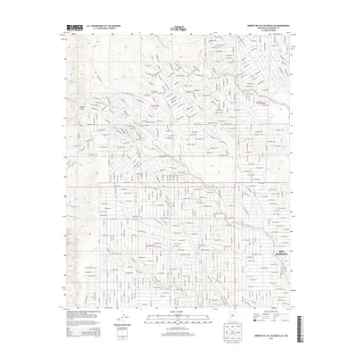
2013 Map of Arroyo de las Calabacillas
USGS Topo · Published 2013About this map
Rio Rancho expanded across the high desert of Sandoval County by the early 21st century, as seen in this detailed study of its northwestern residential growth. The landscape is defined by its dramatic drainage network, where the Arroyo de las Calabacillas and Arroyo de los Montoyas carve deep paths through the arid terrain. The street grid shown here reveals a transitional moment in suburban development, with established residential blocks in the southeast giving way to planned but sparsely populated northern sections.
Find a feature on this map
208 named features on this map. Tap any name to fly to it.
Don’t see what you’re looking for? This feature index may not catch every label — zoom into the map to look around manually.
Map Details
Editions of this 2013 Arroyo de las Calabacillas Map
This is the sole edition of this map. No revisions or reprints were ever made.
Other maps of this area

1888 · Bernalillo
USGS Topo · 1:125,000

1889 · Albuquerque
USGS Topo · 1:125,000

1893 · Albuquerque
USGS Topo · 1:125,000

1934 · Griegos
USGS Topo · 1:24,000

1938 · Albuquerque
USGS Topo · 1:62,500

1953 · Bernalillo NW
USGS Topo · 1:24,000

1954 · Volcano Ranch
USGS Topo · 1:24,000

1954 · Loma Machete
USGS Topo · 1:24,000

1954 · Sky Village
USGS Topo · 1:24,000
1954 · Sky Village SE
USGS Topo · 1:24,000