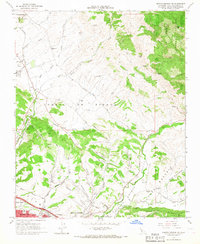
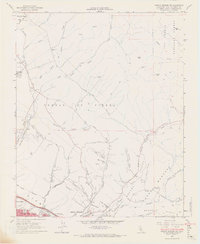
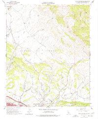
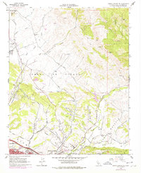
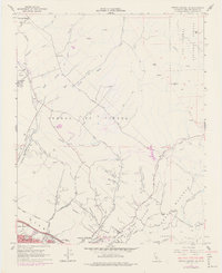
1965 Map of Arroyo Grande NE
USGS Topo · Published 1967About this map
Edna and the northern outskirts of Grover City anchor this mid-1960s survey of the California coast's interior hills. The landscape is defined by the Southern Pacific rail line cutting through the valley and the significant industrial presence of the Arroyo Grande Oil Field to the west. Evidence of early rural education is prominent throughout the region, with several schools like Independence Sch, Los Ranchos Sch, and Branch Sch serving scattered ranching communities. The terrain transitions from the lowlands of Corral de Piedra Creek to the protected highlands of the Los Padres National Forest in the northeast. Notable landmarks include the Airway Beacon near Islay Hill and the winding Arroyo Grande Creek, which carves through the Corralitos Valley toward the coast. This record documents the balance of petroleum extraction and agriculture before late-century suburban expansion.
Find a feature on this map
55 named features on this map. Tap any name to fly to it.
Don’t see what you’re looking for? This feature index may not catch every label — zoom into the map to look around manually.
Map Details
Editions of this 1965 Arroyo Grande NE Map
6 editions found

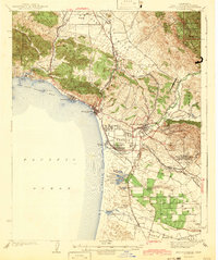
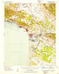
Other maps of this area

1897 · San Luis Obispo
USGS Topo · 1:62,500

1897 · Arroyo Grande
USGS Topo · 1:62,500

1900 · San Luis
USGS Topo · 1:125,000

1922 · Pozo
USGS Topo · 1:62,500

1922 · Nipomo
USGS Topo · 1:62,500

1942 · San Luis Obispo
USGS Topo · 1:62,500
1942 · Arroyo Grande
USGS Topo · 1:62,500

1947 · San Luis Obispo
USGS Topo · 1:250,000

1948 · San Luis Obispo
USGS Topo · 1:250,000
1952 · Arroyo Grande
USGS Topo · 1:62,500