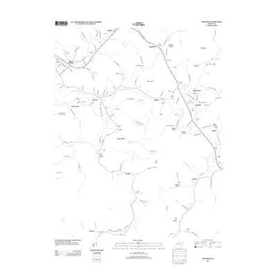
2013 Map of Artemus
USGS Topo · Published 2013About this map
The Cumberland River curves through this Knox County landscape, anchoring a network of small coal and transit communities during the early 21st century. Settlements like Artemus, Flat Lick, and East Jellico are connected by a web of local roads and loops of the old highway system, reflecting the area's long history as a corridor for movement and resource extraction. Evidence of the region's industrial heritage is found at the Powers Coal Camp, while the Mud Creek Lookout Tower stands as a prominent landmark overlooking the valley near Old Flat Lick.
Find a feature on this map
132 named features on this map. Tap any name to fly to it.
Don’t see what you’re looking for? This feature index may not catch every label — zoom into the map to look around manually.
Map Details
Editions of this 2013 Artemus Map
This is the sole edition of this map. No revisions or reprints were ever made.
Other maps of this area

1886 · Cumberland Gap
USGS Topo · 1:125,000

1888 · Cumberland Gap
USGS Topo · 1:125,000

1891 · Cumberland Gap
USGS Topo · 1:125,000

1903 · Pineville
USGS Topo · 1:48,000

1903 · Middlesboro
USGS Topo · 1:48,000

1927 · Middlesboro
USGS Topo · 1:62,500

1930 · Middlesboro
USGS Topo · 1:62,500

1952 · Barbourville
USGS Topo · 1:24,000

1952 · Heidrick
USGS Topo · 1:24,000

1952 · Fount
USGS Topo · 1:24,000