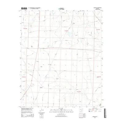
2014 Map of Artesian
USGS Topo · Published 2014About this map
Artesian Oil Field and the Lloyd Creek Oil Field dominate the landscape of Calhoun County, Arkansas, during this 2014 survey. The topography is defined by a complex drainage network where Hurricane Creek and its many tributaries, including Lick Branch and Gilbert Branch, weave through the lowlands. The settlement of Artesian sits near the junction of several local routes, while the Artesian Lookout Tower stands as a prominent landmark for the surrounding timber and oil lands.
Find a feature on this map
83 named features on this map. Tap any name to fly to it.
Don’t see what you’re looking for? This feature index may not catch every label — zoom into the map to look around manually.
Map Details
Editions of this 2014 Artesian Map
This is the sole edition of this map. No revisions or reprints were ever made.
Other maps of this area

1903 · Camden
USGS Topo · 1:125,000

1934 · Moro Bay
USGS Topo · 1:62,500

1938 · Moro Bay
USGS Topo · 1:62,500

1939 · Moro Bay
USGS Topo · 1:62,500

1953 · El Dorado
USGS Topo · 1:250,000

1957 · El Dorado
USGS Topo · 1:250,000

1958 · El Dorado
USGS Topo · 1:250,000

1960 · El Dorado
USGS Topo · 1:250,000

1962 · Smackover NE
USGS Topo · 1:24,000
1962 · Calion
USGS Topo · 1:24,000