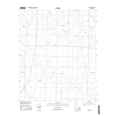
2017 Map of Artesian
USGS Topo · Published 2017About this map
Artesian and Unco define the settled points of this Calhoun County landscape, where small communities are interconnected by a web of rural routes like Lee St and Potlatch Rd. The terrain is deeply carved by a dense network of waterways, with Hurricane Cr and its tributaries, such as Gilbert Br and Rocky Br, flowing through the central and eastern sections. To the west, the landscape transitions toward Little Champagnolle Cr and the low-lying Bangs Slough. Local heritage is anchored by sites like Friendship Cem and Faustina Cem, which serve as primary markers of the area's genealogical history. The map's grid of section lines and township boundaries, including t15s r13w, highlights the traditional land management patterns typical of southern Arkansas.
Find a feature on this map
63 named features on this map. Tap any name to fly to it.
Don’t see what you’re looking for? This feature index may not catch every label — zoom into the map to look around manually.
Map Details
Editions of this 2017 Artesian Map
This is the sole edition of this map. No revisions or reprints were ever made.
Other maps of this area

1903 · Camden
USGS Topo · 1:125,000

1934 · Moro Bay
USGS Topo · 1:62,500

1938 · Moro Bay
USGS Topo · 1:62,500

1939 · Moro Bay
USGS Topo · 1:62,500

1953 · El Dorado
USGS Topo · 1:250,000

1957 · El Dorado
USGS Topo · 1:250,000

1958 · El Dorado
USGS Topo · 1:250,000

1960 · El Dorado
USGS Topo · 1:250,000

1962 · Smackover NE
USGS Topo · 1:24,000
1962 · Calion
USGS Topo · 1:24,000