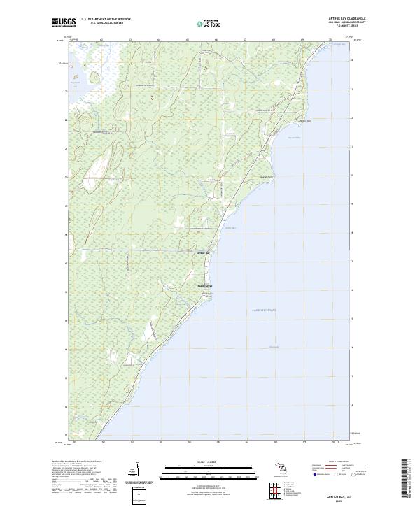
2023 Map of Arthur Bay
USGS Topo · Published 2023About this map
Arthur Bay and Beach Grove line the western shores of Lake Michigan along this stretch of the Menominee County coast. This survey illustrates the intricate drainage system of the Upper Peninsula, where numerous small waterways like Ruleau Creek, Fowler Creek, and Rochereau Creek empty into Green Bay. The interior landscape is dominated by dense wetlands and low-lying terrain, punctuated by named water bodies such as Hayward Lake and Little Lake. The coastal geography is defined by distinct landmarks including Harbor Point, Sawyer Point, and Rochereau Point. A network of logging roads and local lanes, such as Cherry Ridge Logging Rd and Hayward Lake Rd No 17, provides access to the heavily forested inland sections, reflecting the region's enduring connection to the timber industry and its localized settlement patterns.
Find a feature on this map
42 named features on this map. Tap any name to fly to it.
Don’t see what you’re looking for? This feature index may not catch every label — zoom into the map to look around manually.
Map Details
Editions of this 2023 Arthur Bay Map
This is the sole edition of this map. No revisions or reprints were ever made.
Other maps of this area

1939 · Marinette
USGS Topo · 1:48,000

1949 · Stephenson
USGS Topo · 1:48,000

1954 · Escanaba
USGS Topo · 1:250,000

1957 · Escanaba
USGS Topo · 1:250,000

1958 · Escanaba
USGS Topo · 1:250,000

1961 · Chambers Island
USGS Topo · 1:62,500

1963 · Cedar River
USGS Topo · 1:62,500
1963 · Birch Creek
USGS Topo · 1:24,000

1963 · Stephenson
USGS Topo · 1:62,500
1963 · Marinette
USGS Topo · 1:62,500