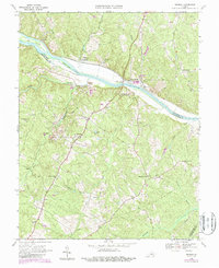
1968 Map of Arvonia
USGS Topo · Published 1987About this map
The James River corridor defines this Virginia landscape, where industrial sites and historic estates meet along the border of Fluvanna and Buckingham counties. The map documents the mid-century intersection of river commerce and rail transport, featuring the C&O and CSX lines threading through the valley. Significant architectural landmarks are noted, including the Upper Bremo Mansion and Lower Bremo Mansion near Bremo Bluff, situated near a large modern Powerplant.
Find a feature on this map
49 named features on this map. Tap any name to fly to it.
Don’t see what you’re looking for? This feature index may not catch every label — zoom into the map to look around manually.
Map Details
Editions of this 1968 Arvonia Map
2 editions found
Other maps of this area

1891 · Palmyra
USGS Topo · 1:125,000

1895 · Palmyra
USGS Topo · 1:125,000

1897 · Palmyra
USGS Topo · 1:125,000

1943 · Scottsville
USGS Topo · 1:62,500

1946 · Scottsville
USGS Topo · 1:62,500

1947 · Roanoke
USGS Topo · 1:250,000

1950 · Dillwyn
USGS Topo · 1:62,500

1958 · Dillwyn
USGS Topo · 1:62,500

1959 · Roanoke
USGS Topo · 1:250,000

1960 · Columbia
USGS Topo · 1:62,500