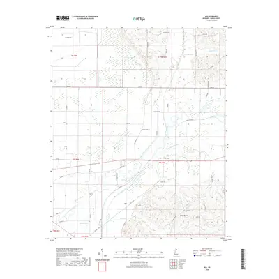
2020 Map of Asa
USGS Topo · Published 2020About this map
The Little Tallahatchie River and its complex network of seasonal waterways define this portion of Panola County. The landscape is marked by the shifting path of the river, with the Old Little Tallahatchie River and Running Slough Ditch illustrating historical hydrological changes. The small settlement of Asa sits near the riverbanks, while the community of Chapeltown is located to the southeast, anchored by the Chapeltown Cem. Local family history is preserved through numerous named roads and landmarks, including McIvor Cem and the distinctive Nelsons Bluff. The map also captures several smaller drainages such as Rayburn Bayou, O'Brien Cr, and Hayne Cr, which drain the low-lying terrain. To the north, the label Viney Rough suggests a specific character to the local woods or topography, while Squirrel Bridge indicates an established crossing point for the rural road network.
Find a feature on this map
53 named features on this map. Tap any name to fly to it.
Don’t see what you’re looking for? This feature index may not catch every label — zoom into the map to look around manually.
Map Details
Editions of this 2020 Asa Map
This is the sole edition of this map. No revisions or reprints were ever made.
Other maps of this area

1932 · Sledge
USGS Topo · 1:48,000

1935 · Crowder
USGS Topo · 1:62,500

1935 · Sledge
USGS Topo · 1:62,500

1939 · Sledge
USGS Topo · 1:62,500

1939 · Crowder
USGS Topo · 1:62,500

1948 · Helena
USGS Topo · 1:250,000

1950 · Helena
USGS Topo · 1:250,000

1952 · Sardis
USGS Topo · 1:62,500

1953 · Sardis
USGS Topo · 1:62,500

1954 · Oakland
USGS Topo · 1:62,500