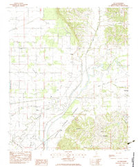
1983 Map of Asa
USGS Topo · Published 1983About this map
The Little Tallahatchie River meanders across this landscape, defining a region where water management and agriculture are inextricably linked. The massive Panola Quitman Floodway cuts a straight path through the territory, a stark engineered contrast to the winding natural channels of Beech Bayou and Rayburn Bayou. This 1983 survey captures the rural character of Panola County, where small communities like Chapeltown and Asa serve as local hubs.
Find a feature on this map
27 named features on this map. Tap any name to fly to it.
Don’t see what you’re looking for? This feature index may not catch every label — zoom into the map to look around manually.
Map Details
Editions of this 1983 Asa Map
This is the sole edition of this map. No revisions or reprints were ever made.
Other maps of this area

1932 · Sledge
USGS Topo · 1:48,000

1935 · Crowder
USGS Topo · 1:62,500

1935 · Sledge
USGS Topo · 1:62,500

1939 · Sledge
USGS Topo · 1:62,500

1939 · Crowder
USGS Topo · 1:62,500

1948 · Helena
USGS Topo · 1:250,000

1950 · Helena
USGS Topo · 1:250,000

1952 · Sardis
USGS Topo · 1:62,500

1953 · Sardis
USGS Topo · 1:62,500

1954 · Oakland
USGS Topo · 1:62,500