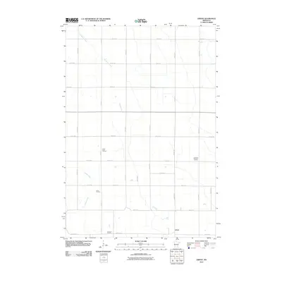
2010 Map of Asbury
USGS Topo · Published 2010About this map
Asbury anchors the southeastern corner of this rural agricultural landscape in Chippewa County, where a precise grid of township roads defines the prairie. The map reveals a high density of memorial sites for a rural area, suggesting a deep-rooted community history anchored by the Palmer Creek Cemetery, Leenthrop Memorial Cemetery, Saron Cemetery, and Swensson Cemetery. These burial grounds are often situated near the gentle meandering paths of seasonal waterways, including Dry Weather Creek and Brafees Creek. The dominance of named family and memorial landmarks over commercial centers highlights the area's genealogical significance, while the drainage patterns of Palmer Creek illustrate the natural topography that dictated early settlement and field boundaries. This 2010 survey by the U. S. Geological Survey preserves the layout of the region's county highway system, such as County Hwy-15, which serves as a primary east-west artery through the township.
Find a feature on this map
31 named features on this map. Tap any name to fly to it.
Don’t see what you’re looking for? This feature index may not catch every label — zoom into the map to look around manually.
Map Details
Editions of this 2010 Asbury Map
This is the sole edition of this map. No revisions or reprints were ever made.
Other maps of this area

1953 · New Ulm
USGS Topo · 1:250,000

1953 · Saint Cloud
USGS Topo · 1:250,000

1957 · Saint Cloud
USGS Topo · 1:250,000

1957 · New Ulm
USGS Topo · 1:250,000

1958 · New Ulm
USGS Topo · 1:250,000

1958 · Saint Cloud
USGS Topo · 1:250,000

1958 · Kerkhoven SW
USGS Topo · 1:24,000

1958 · Gracelock
USGS Topo · 1:24,000

1958 · Gracelock SW
USGS Topo · 1:24,000

1965 · Montevideo
USGS Topo · 1:24,000