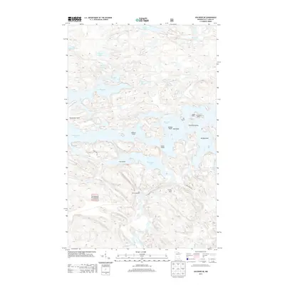
2013 Map of Ash River NE
USGS Topo · Published 2013About this map
The Superior National Forest dominates this northern Minnesota landscape, where the intricate shorelines of Kabetogama Lake and Namakan Lake meet. The map reveals a labyrinth of water and land, characterized by numerous named islands such as Boblore Island, Foote Island, and Filla Island. For those researching local landmarks or genealogical sites, the presence of Cemetery Island and Indian Point near Tar Point provides specific points of interest.
Find a feature on this map
31 named features on this map. Tap any name to fly to it.
Don’t see what you’re looking for? This feature index may not catch every label — zoom into the map to look around manually.
Map Details
Editions of this 2013 Ash River NE Map
This is the sole edition of this map. No revisions or reprints were ever made.
Other maps of this area

1954 · International Falls
USGS Topo · 1:250,000

1957 · International Falls
USGS Topo · 1:250,000

1958 · International Falls
USGS Topo · 1:250,000

1967 · Namakan Island
USGS Topo · 1:24,000

1967 · Marion Lake
USGS Topo · 1:24,000

1967 · Kempton Bay
USGS Topo · 1:24,000
1967 · Kettle Falls
USGS Topo · 1:24,000

1968 · Soldier Point
USGS Topo · 1:24,000

1968 · Daley Bay
USGS Topo · 1:24,000

1968 · Ash River SE
USGS Topo · 1:24,000