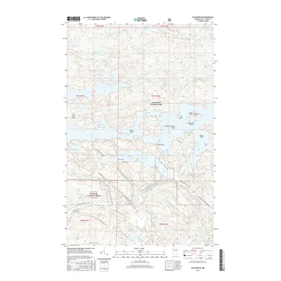
2016 Map of Ash River NE
USGS Topo · Published 2016About this map
Namakan Lake and Kabetogama Lake dominate this northern landscape, where an intricate network of waterways and islands defines the boundary between Voyageurs National Park and the Superior National Forest. This 2016 survey highlights a region shaped by wilderness recreation and conservation, featuring the extensive Voyageur Snowmobile Trail and access roads like Ash River Trl. The map documents numerous named islands such as Boblore Island and Sweetnose Island, alongside the narrow passages of the Blind Indian Narrows. Evidence of earlier local history is preserved at a small Cemetery near Indian Point, while inland, smaller bodies of water like Cruiser Lake and Jorgens Lake sit among high ridges. The map captures the specialized infrastructure of the park system, including Camp Ninety Creek and the southern flow of the Ash River.
Find a feature on this map
48 named features on this map. Tap any name to fly to it.
Don’t see what you’re looking for? This feature index may not catch every label — zoom into the map to look around manually.
Map Details
Editions of this 2016 Ash River NE Map
This is the sole edition of this map. No revisions or reprints were ever made.
Other maps of this area

1954 · International Falls
USGS Topo · 1:250,000

1957 · International Falls
USGS Topo · 1:250,000

1958 · International Falls
USGS Topo · 1:250,000

1967 · Namakan Island
USGS Topo · 1:24,000

1967 · Marion Lake
USGS Topo · 1:24,000

1967 · Kempton Bay
USGS Topo · 1:24,000
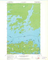
1967 · Kettle Falls
USGS Topo · 1:24,000

1968 · Soldier Point
USGS Topo · 1:24,000

1968 · Daley Bay
USGS Topo · 1:24,000

1968 · Ash River SE
USGS Topo · 1:24,000