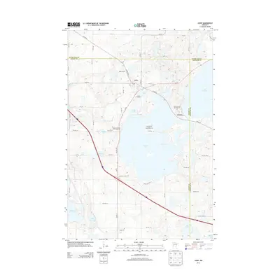
2013 Map of Ashby
USGS Topo · Published 2013About this map
Ashby serves as the central hub of this lakeside landscape, where the borders of Grant Co, Douglas Co, and Otter Tail Co converge. The topography is defined by a dense concentration of glacial basins, ranging from the expansive Pelican Lake and Lake Christina to smaller waters like Slotsve Lake and Shady Grove Lake. This 2013 edition documents a region deeply tied to its glacial history and recreational economy, evidenced by the cluster of sites including Indian Mounds Resort and Campgrounds and the Native American Burial Grounds overlooking the water. Transportation follows both modern and historical lines, with MN-78 and Co HWY-82 cutting through the terrain near the small settlement of Melby and its associated Melby Airport. Genealogists will find the locations of local resting places like Pelican Lake Cem and Erdahl Cem clearly marked among the farm roads and lakefronts.
Find a feature on this map
61 named features on this map. Tap any name to fly to it.
Don’t see what you’re looking for? This feature index may not catch every label — zoom into the map to look around manually.
Map Details
Editions of this 2013 Ashby Map
This is the sole edition of this map. No revisions or reprints were ever made.
Other maps of this area

1911 · Barrett
USGS Topo · 1:62,500

1913 · Ashby
USGS Topo · 1:62,500

1953 · Brainerd
USGS Topo · 1:250,000

1953 · Saint Cloud
USGS Topo · 1:250,000

1957 · Brainerd
USGS Topo · 1:250,000

1957 · Saint Cloud
USGS Topo · 1:250,000

1958 · Saint Cloud
USGS Topo · 1:250,000

1958 · Brainerd
USGS Topo · 1:250,000

1965 · Brainerd
USGS Topo · 1:250,000

1966 · Quam Lake
USGS Topo · 1:24,000