2022 Map of Ashby
USGS Topo · Published 2022About this map
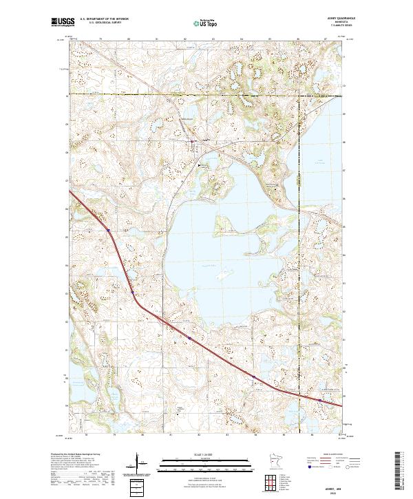
Ashby sits at a crossroads of water and transport in this modern survey of the Grant County landscape. The town is flanked by a dense cluster of lakes, most notably Pelican Lake, Lake Christina, and Little Lake, which define the local geography. Significant for genealogists and local historians, the map identifies the Pelican Lake Cem, the Erdahl Lutheran Cem, and an area of Native American Burial Grounds near Ask Lake. The transition from rail to recreation is evident in the Central Lakes State Trl, which follows a former railroad corridor through the center of town. North of the settlement, Melby Airport provides a small aviation hub, while the surrounding terrain is dotted with smaller bodies of water like Slotsye Lake and Werson Lake. The map clearly delineates the tri-county border where Grant, Otter Tail, and Douglas counties meet, highlighting the administrative complexity of this lake-strewn region.
Find a feature on this map
79 named features on this map. Tap any name to fly to it.
Don’t see what you’re looking for? This feature index may not catch every label — zoom into the map to look around manually.
Map Details
Editions of this 2022 Ashby Map
This is the sole edition of this map. No revisions or reprints were ever made.