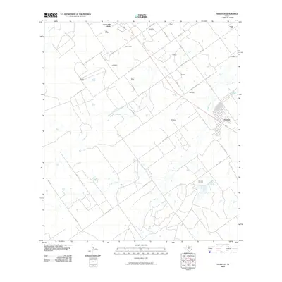
2010 Map of Asherton
USGS Topo · Published 2010About this map
The town of Asherton serves as the primary urban center in this South Texas landscape, defined by a grid of agricultural and residential labels that indicate a history of ranching and land ownership. Numerous family-named properties such as Joe White, Erskine Rhodes, and CW Bonham are scattered throughout the territory, linked by a network of county roads like La Martita County Rd and Martinez County Rd. Water management is central to the area's utility, evidenced by the Marmion Lake Dam and the winding paths of El Moro Creek and El Barrosa Creek. The presence of the Carrizo Hills Colonia at the northern edge reflects the regional settlement patterns of Dimmit County during this era, while smaller holdings like Eardly Farm maintain the rural character of the terrain.
Find a feature on this map
42 named features on this map. Tap any name to fly to it.
Don’t see what you’re looking for? This feature index may not catch every label — zoom into the map to look around manually.
Map Details
Editions of this 2010 Asherton Map
This is the sole edition of this map. No revisions or reprints were ever made.
Other maps of this area

1929 · Cotulla
USGS Topo · 1:125,000

1932 · Valley Wells
USGS Topo · 1:62,500

1939 · Carrizo Springs
USGS Topo · 1:62,500

1939 · Big Wells
USGS Topo · 1:62,500

1940 · Asherton
USGS Topo · 1:62,500

1940 · Catarina
USGS Topo · 1:62,500

1953 · Crystal City
USGS Topo · 1:250,000

1955 · Crystal City
USGS Topo · 1:250,000

1961 · Crystal City
USGS Topo · 1:250,000

1968 · Crystal City
USGS Topo · 1:250,000