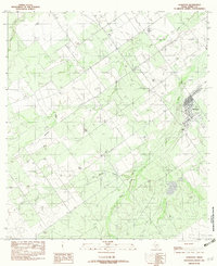
1982 Map of Asherton
USGS Topo · Published 1982About this map
Asherton anchors the eastern edge of this Dimmit County landscape, appearing here as a concentrated grid of streets and structures during the early 1980s. The surrounding terrain is defined by a dendritic network of ephemeral drainage systems, most notably Carrizo Creek, El Morrito Creek, and El Barrosa Creek. These watercourses carve through the brush country, illustrating the vital role of seasonal hydrology in this semi-arid region of South Texas. Evidence of local infrastructure and resource extraction is visible in the form of a Landing Strip and a Gravel Pit, reflecting the area's mid-century economic activities. The map captures a moment of transition between the ranching-dominated past and more modern industrial developments, documented through fieldwork conducted in 1976.
Find a feature on this map
7 named features on this map. Tap any name to fly to it.
Don’t see what you’re looking for? This feature index may not catch every label — zoom into the map to look around manually.
Map Details
Editions of this 1982 Asherton Map
This is the sole edition of this map. No revisions or reprints were ever made.
Other maps of this area

1929 · Cotulla
USGS Topo · 1:125,000

1932 · Valley Wells
USGS Topo · 1:62,500

1939 · Carrizo Springs
USGS Topo · 1:62,500

1939 · Big Wells
USGS Topo · 1:62,500

1940 · Asherton
USGS Topo · 1:62,500

1940 · Catarina
USGS Topo · 1:62,500

1953 · Crystal City
USGS Topo · 1:250,000

1955 · Crystal City
USGS Topo · 1:250,000

1961 · Crystal City
USGS Topo · 1:250,000

1968 · Crystal City
USGS Topo · 1:250,000