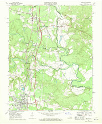
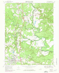
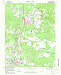
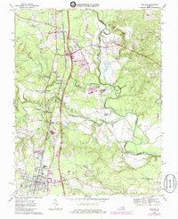
1969 Map of Ashland
USGS Topo · Published 1970About this map
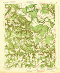
Ashland serves as a significant educational and transportation hub in this late-1960s survey, defined by the presence of Randolph-Macon College and the intersecting routes of the Richmond Fredericksburg and Potomac and the Chesapeake and Ohio railroads. The landscape is deeply influenced by the waterways of the South Anna River and the Little River, where numerous crossings such as Morris Bridge and Little River Crossing facilitate movement between rural communities. Educational history is further highlighted by the Gandy High Sch and Hanover Academy, while smaller settlements like Gum Tree and Taylorsville preserve the area's agricultural character.
Find a feature on this map
45 named features on this map. Tap any name to fly to it.
Don’t see what you’re looking for? This feature index may not catch every label — zoom into the map to look around manually.
Map Details
Editions of this 1969 Ashland Map
4 editions found
Other maps of this area

1890 · Goochland
USGS Topo · 1:125,000

1892 · Goochland
USGS Topo · 1:125,000

1894 · Richmond
USGS Topo · 1:62,500

1895 · Richmond
USGS Topo · 1:62,500

1918 · Doswell
USGS Topo · 1:62,500

1936 · Glen Allen
USGS Topo · 1:24,000
1938 · Studley
USGS Topo · 1:31,680

1938 · Yellow Tavern
USGS Topo · 1:31,680

1941 · Glen Allen
USGS Topo · 1:31,680
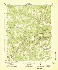
1943 · Hanover Academy
USGS Topo · 1:31,680