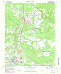
1969 Map of Ashland
USGS Topo · Published 1981About this map
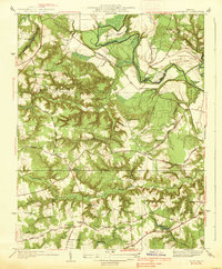
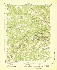
Ashland serves as the focal point of this Hanover County survey, notably home to the historic campus of Randolph-Macon College and local institutions like Gandy High Sch and Henry Clay Sch. The landscape is defined by the convergence of major waterways, including the North Anna River, Little River, and South Anna River, which meet to form the Pamunkey River. The rail infrastructure of the Richmond Fredericksburg and Potomac and the Chesapeake and Ohio railroads anchors the industrial and transit character of the era, connecting settlements such as Doswell and Taylorsville. A significant addition to the late 1970s landscape appears in purple revisions, showing the early layout of Kings Dominion Amusement Park near Garnett Crossing. This transition period records a mix of traditional rural life, evidenced by Ashland Mill and numerous country churches like Providence Ch, alongside modern regional developments.
Find a feature on this map
49 named features on this map. Tap any name to fly to it.
Don’t see what you’re looking for? This feature index may not catch every label — zoom into the map to look around manually.
Map Details
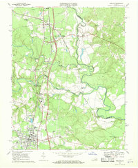
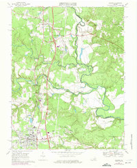
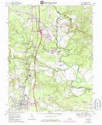
Editions of this 1969 Ashland Map
4 editions found
Other maps of this area

1890 · Goochland
USGS Topo · 1:125,000

1892 · Goochland
USGS Topo · 1:125,000

1894 · Richmond
USGS Topo · 1:62,500

1895 · Richmond
USGS Topo · 1:62,500

1918 · Doswell
USGS Topo · 1:62,500

1936 · Glen Allen
USGS Topo · 1:24,000
1938 · Studley
USGS Topo · 1:31,680

1938 · Yellow Tavern
USGS Topo · 1:31,680

1941 · Glen Allen
USGS Topo · 1:31,680
1943 · Hanover Academy
USGS Topo · 1:31,680