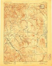
1893 Map of Ashland
USGS Topo · Published 1907About this map
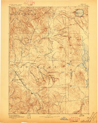
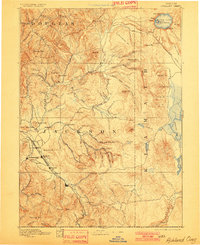
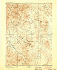
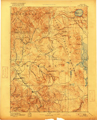
Crater Lake and its volcanic landscape dominate the northeast corner of this late 19th-century survey, featuring prominent landmarks like Wizard Id., Llao Rock, and Watchman Pk. within the rim. To the southwest, the valley floor of the Bear Creek watershed is the primary corridor for settlement and transport. The Oregon and California R. R. connects the growing towns of Medford, Jacksonville, Phoenix, and Ashland, illustrating the rail-driven development of Southern Oregon during this era.
Find a feature on this map
112 named features on this map. Tap any name to fly to it.
Don’t see what you’re looking for? This feature index may not catch every label — zoom into the map to look around manually.
Map Details
Editions of this 1893 Ashland Map
6 editions found
Other maps of this area

1886 · Modoc Lava Bed
USGS Topo · 1:250,000

1886 · Shasta
USGS Topo · 1:250,000

1889 · Klamath
USGS Topo · 1:250,000

1891 · Ashland
USGS Topo · 1:250,000

1892 · Modoc Lava-Bed
USGS Topo · 1:250,000

1893 · Ashland
USGS Topo · 1:250,000

1894 · Klamath
USGS Topo · 1:250,000

1894 · Shasta
USGS Topo · 1:250,000

1897 · Roseburg
USGS Topo · 1:125,000

1897 · Ashland
USGS Topo · 1:250,000