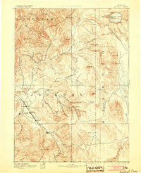
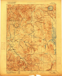
1893 Map of Ashland
USGS Topo · Published 1905About this map
The Oregon and California R. R. defines the industrial spine of the Rogue River Valley on this late 19th-century reconnaissance sheet, linking the growing agricultural and commercial hubs of Medford, Ashland, and the county seat at Jacksonville. This era captures the transition of the region from mining and timber frontiers into a more settled orchard and rail economy, with small stations like Phoenix, Talent, and Central Point appearing as key nodes along the tracks.
Find a feature on this map
105 named features on this map. Tap any name to fly to it.
Don’t see what you’re looking for? This feature index may not catch every label — zoom into the map to look around manually.
Map Details
Editions of this 1893 Ashland Map
6 editions found
Other maps of this area

1886 · Modoc Lava Bed
USGS Topo · 1:250,000

1886 · Shasta
USGS Topo · 1:250,000

1889 · Klamath
USGS Topo · 1:250,000

1891 · Ashland
USGS Topo · 1:250,000

1892 · Modoc Lava-Bed
USGS Topo · 1:250,000

1893 · Ashland
USGS Topo · 1:250,000

1894 · Klamath
USGS Topo · 1:250,000

1894 · Shasta
USGS Topo · 1:250,000

1897 · Roseburg
USGS Topo · 1:125,000

1897 · Ashland
USGS Topo · 1:250,000