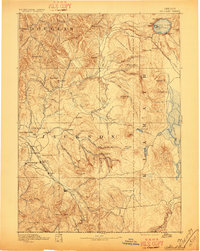
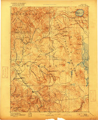
1893 Map of Ashland
USGS Topo · Published 1897About this map
Jacksonville and the emerging rail corridor through the Rogue River Valley define this 1890s landscape. The Oregon and California R. R. connects early hubs like Medford, Talent, and Central Point, tracing the path of Bear Creek as it moves south toward Ashland. While the valley floor shows the beginnings of steady settlement, the surrounding terrain remains dominated by prominent landmarks like Upper Table Rock and Lower Table Rock.
Find a feature on this map
95 named features on this map. Tap any name to fly to it.
Don’t see what you’re looking for? This feature index may not catch every label — zoom into the map to look around manually.
Map Details
Editions of this 1893 Ashland Map
6 editions found
Other maps of this area

1886 · Modoc Lava Bed
USGS Topo · 1:250,000

1886 · Shasta
USGS Topo · 1:250,000

1889 · Klamath
USGS Topo · 1:250,000

1891 · Ashland
USGS Topo · 1:250,000

1892 · Modoc Lava-Bed
USGS Topo · 1:250,000

1893 · Ashland
USGS Topo · 1:250,000

1894 · Klamath
USGS Topo · 1:250,000

1894 · Shasta
USGS Topo · 1:250,000

1897 · Roseburg
USGS Topo · 1:125,000

1897 · Ashland
USGS Topo · 1:250,000