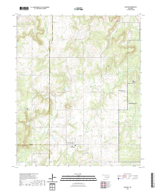
2022 Map of Ashland
USGS Topo · Published 2022About this map
Ashland serves as a central hub in this corner of Pittsburg County, situated near the intersection of several local routes like Ashland Rd and E155 Rd. The landscape is defined by the winding paths of Hominy Cr and Ranch Cr, which cut through a terrain of notable rises and hollows. For those researching local families, the map identifies several vital interment sites, including Ashland Cem, the Bohannon Cem to the northwest, and the Ward Springs Cem located near the settlement of Ward Springs.
Find a feature on this map
50 named features on this map. Tap any name to fly to it.
Don’t see what you’re looking for? This feature index may not catch every label — zoom into the map to look around manually.
Map Details
Editions of this 2022 Ashland Map
This is the sole edition of this map. No revisions or reprints were ever made.
Other maps of this area

1896 · Coalgate
USGS Topo · 1:125,000

1898 · McAlester
USGS Topo · 1:125,000

1899 · Coalgate
USGS Topo · 1:125,000

1900 · Coalgate
USGS Topo · 1:125,000

1909 · Mc Alester
USGS Topo · 1:125,000

1950 · Mcalester
USGS Topo · 1:250,000

1957 · Ardmore
USGS Topo · 1:250,000

1962 · McAlester
USGS Topo · 1:250,000

1963 · Ardmore
USGS Topo · 1:250,000

1965 · McAlester
USGS Topo · 1:250,000