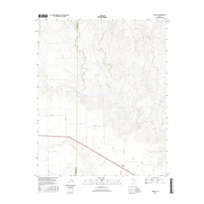
2016 Map of Ashtola
USGS Topo · Published 2016About this map
Ashtola stands as the primary settlement in this corner of Donley County, situated at the intersection of several rural routes including Ranch Rd 2362 and Co Rd 6. The geography is defined by the significant braided path of the Salt Fork Red River, which serves as a central drainage point for numerous intermittent tributaries. The landscape to the north of the river is particularly dissected by drainage systems like Rawhide Creek and Sandy Creek, while the southern portion is characterized by a more regular grid of county roads. The boundary between Armstrong Co and Donley Co runs vertically through the western third of the map, illustrating how early political lines bisected the natural drainage basins of Cottonwood Cr and McCullum Cr. This survey provides a clear view of the ranching and agricultural road network that sustains this High Plains community.
Find a feature on this map
24 named features on this map. Tap any name to fly to it.
Don’t see what you’re looking for? This feature index may not catch every label — zoom into the map to look around manually.
Map Details
Editions of this 2016 Ashtola Map
This is the sole edition of this map. No revisions or reprints were ever made.
Other maps of this area

1954 · Amarillo
USGS Topo · 1:250,000

1954 · Plainview
USGS Topo · 1:250,000

1958 · Amarillo
USGS Topo · 1:250,000

1958 · Plainview
USGS Topo · 1:250,000

1960 · Groom
USGS Topo · 1:62,500

1962 · Roach Ranch
USGS Topo · 1:24,000

1963 · Blue Hole Springs
USGS Topo · 1:24,000

1963 · Clarendon
USGS Topo · 1:24,000

1963 · Buffalo Arroyo
USGS Topo · 1:24,000

1964 · Jericho
USGS Topo · 1:24,000