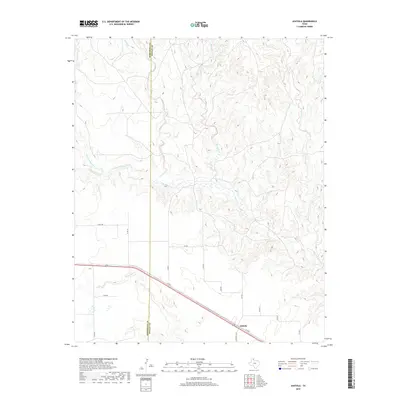
2019 Map of Ashtola
USGS Topo · Published 2019About this map
The settlement of Ashtola sits at the intersection of rural ranch roads in this high plains landscape on the border of Armstrong and Donley counties. The terrain is deeply defined by the drainage network of the Salt Fork Red River, which cuts across the western half of the map, fed by numerous tributaries including Cottonwood Cr and McCullum Cr. To the north and east, the land is carved by the winding paths of Rawhide Cr and Record Cr, creating a complex system of draws and breaks characteristic of the Texas Panhandle.
Find a feature on this map
25 named features on this map. Tap any name to fly to it.
Don’t see what you’re looking for? This feature index may not catch every label — zoom into the map to look around manually.
Map Details
Editions of this 2019 Ashtola Map
This is the sole edition of this map. No revisions or reprints were ever made.
Other maps of this area

1954 · Amarillo
USGS Topo · 1:250,000

1954 · Plainview
USGS Topo · 1:250,000

1958 · Amarillo
USGS Topo · 1:250,000

1958 · Plainview
USGS Topo · 1:250,000

1960 · Groom
USGS Topo · 1:62,500

1962 · Roach Ranch
USGS Topo · 1:24,000

1963 · Blue Hole Springs
USGS Topo · 1:24,000

1963 · Clarendon
USGS Topo · 1:24,000

1963 · Buffalo Arroyo
USGS Topo · 1:24,000

1964 · Jericho
USGS Topo · 1:24,000