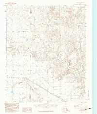
1983 Map of Ashtola
USGS Topo · Published 1984About this map
The Ashtola community sits amidst the ranching lands and eroded breaks of the Texas Panhandle in this early 1980s survey. The landscape is defined by the Salt Fork Red River, which carves a winding path across the terrain, supplemented by a network of seasonal drainages including Sandy Creek, Rawhide Creek, and Record Creek. This territory straddles the Armstrong Co Donley Co line, where an Indefinite Boundary suggests the historical complexities of surveying in these open spaces.
Find a feature on this map
9 named features on this map. Tap any name to fly to it.
Don’t see what you’re looking for? This feature index may not catch every label — zoom into the map to look around manually.
Map Details
Editions of this 1983 Ashtola Map
This is the sole edition of this map. No revisions or reprints were ever made.
Other maps of this area

1954 · Amarillo
USGS Topo · 1:250,000

1954 · Plainview
USGS Topo · 1:250,000

1958 · Amarillo
USGS Topo · 1:250,000

1958 · Plainview
USGS Topo · 1:250,000

1960 · Groom
USGS Topo · 1:62,500

1962 · Roach Ranch
USGS Topo · 1:24,000

1963 · Blue Hole Springs
USGS Topo · 1:24,000

1963 · Clarendon
USGS Topo · 1:24,000

1963 · Buffalo Arroyo
USGS Topo · 1:24,000

1964 · Jericho
USGS Topo · 1:24,000