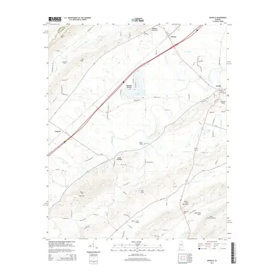
2014 Map of Ashville
USGS Topo · Published 2014About this map
Ashville serves as the focal point of this St. Clair County landscape, where the ridges of Blount Mtn and Barker Mtn define a terrain of distinct valleys and gaps. The map documents a geography shaped by water and elevation, from the Beaver Creek Mountains in the south to the broad Slash Ham Valley in the northeast. Local history is anchored by sites like Reeves Grove Cem and Moore Cem, while small communities such as Whitney Junction and Caldwell trace the corridor of transport and settlement along the base of the ridges. The central portion of the map highlights residential developments like Pinedale Shores bordering Pinedale Lake, illustrating how the region's natural hydrology, including the winding Big Canoe Cr, has influenced modern land use and community placement within the Piedmont's foothills.
Find a feature on this map
99 named features on this map. Tap any name to fly to it.
Don’t see what you’re looking for? This feature index may not catch every label — zoom into the map to look around manually.
Map Details
Editions of this 2014 Ashville Map
This is the sole edition of this map. No revisions or reprints were ever made.
Other maps of this area

1889 · Springville
USGS Topo · 1:125,000

1892 · Springville
USGS Topo · 1:125,000

1947 · Cox Gap
USGS Topo · 1:24,000

1947 · Ragland
USGS Topo · 1:62,500

1947 · Ragland
USGS Topo · 1:24,000

1947 · Steele
USGS Topo · 1:24,000

1947 · Steele
USGS Topo · 1:62,500

1953 · Birmingham
USGS Topo · 1:250,000

1956 · Birmingham
USGS Topo · 1:250,000

1957 · Birmingham
USGS Topo · 1:250,000