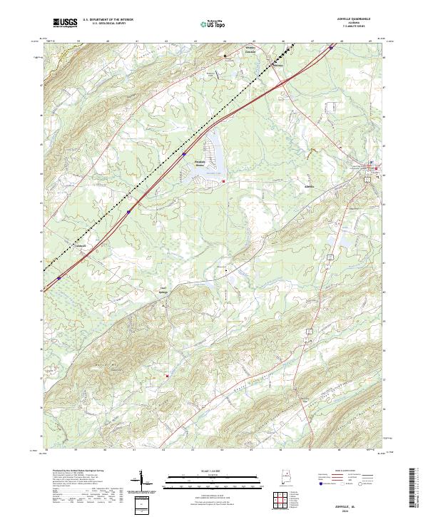
2024 Map of Ashville
USGS Topo · Published 2024About this map
Ashville serves as the focal point of this St. Clair County landscape, anchored by the Saint Clair County Courthouse. The terrain is defined by a series of parallel ridges including Pine Ridge, Big Ridge, and the Beaver Creek Mountains, which channel the flow of Big Canoe Creek and its various tributaries. These valleys historically dictated the path of local travel and settlement, seen here in the linear development along the Beaver Creek Valley and the smaller coves like Crawfords Cove and Calvert Cove tucked into the base of Blount Mountain.
Find a feature on this map
116 named features on this map. Tap any name to fly to it.
Don’t see what you’re looking for? This feature index may not catch every label — zoom into the map to look around manually.
Map Details
Editions of this 2024 Ashville Map
This is the sole edition of this map. No revisions or reprints were ever made.
Other maps of this area

1889 · Springville
USGS Topo · 1:125,000

1892 · Springville
USGS Topo · 1:125,000

1947 · Cox Gap
USGS Topo · 1:24,000

1947 · Ragland
USGS Topo · 1:62,500

1947 · Ragland
USGS Topo · 1:24,000

1947 · Steele
USGS Topo · 1:24,000

1947 · Steele
USGS Topo · 1:62,500

1953 · Birmingham
USGS Topo · 1:250,000

1956 · Birmingham
USGS Topo · 1:250,000

1957 · Birmingham
USGS Topo · 1:250,000