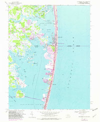
1967 Map of Assawoman Bay
USGS Topo · Published 1982About this map
The coastal boundary between Maryland and Delaware comes alive on Fenwick Island, where the narrow barrier strip separates the Atlantic Ocean from the intricate marshlands of Little Assawoman Bay. This survey captures the mid-century development of the Atlantic coastline, showing the dense grid of Ocean City and Maryland Beach as they expand northward. The purple photorevised layers highlight significant residential growth in communities like Keen-Wik and Swann Keys, illustrating the rapid post-war transformation of the Delmarva shoreline into a vacation destination.
Find a feature on this map
83 named features on this map. Tap any name to fly to it.
Don’t see what you’re looking for? This feature index may not catch every label — zoom into the map to look around manually.
Map Details
Editions of this 1967 Assawoman Bay Map
4 editions found
Other maps of this area

1901 · Ocean City
USGS Topo · 1:62,500

1918 · Rehoboth
USGS Topo · 1:62,500

1938 · Rehoboth
USGS Topo · 1:62,500

1942 · Ocean City
USGS Topo · 1:62,500

1942 · Ocean City
USGS Topo · 1:24,000

1943 · Selbyville
USGS Topo · 1:31,680
1943 · Berlin
USGS Topo · 1:31,680
1943 · Ocean City
USGS Topo · 1:31,680
1943 · Assawoman Bay
USGS Topo · 1:31,680
1943 · Bethany Beach
USGS Topo · 1:24,000