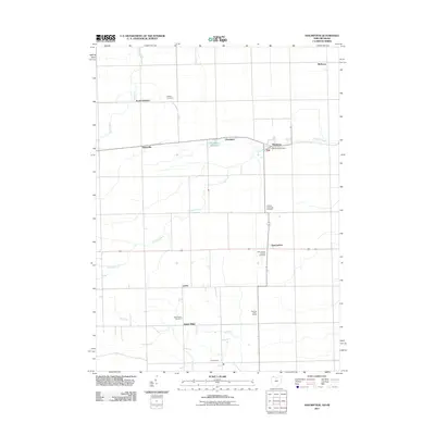
2011 Map of Assumption
USGS Topo · Published 2011About this map
Tenmile Creek and Ai Creek meander through this agricultural landscape on the border of Ohio and Michigan. The area is defined by its small crossroads settlements and family farms, such as Dowling Dairy Farms. The village of Metamora serves as a local hub, featuring the Metamora Post Office and the nearby Metamora Reservoir. This survey provides a clear look at the rural township structure, marked by numerous burial grounds including Amboy Township Cemetery and Saint Marys Catholic Cemetery. Other distinct community nodes like Assumption, Lytton, and Dutch Ridge anchor the grid of country roads, while larger water features like Bear Creek drain the northern reaches. For local historians, the map preserves the exact locations of many scattered heritage sites, including the Peebles Cemetery and the tiny settlement of Ai.
Find a feature on this map
20 named features on this map. Tap any name to fly to it.
Don’t see what you’re looking for? This feature index may not catch every label — zoom into the map to look around manually.
Map Details
Editions of this 2011 Assumption Map
This is the sole edition of this map. No revisions or reprints were ever made.
Other maps of this area

1911 · Wauseon
USGS Topo · 1:62,500

1911 · Swanton
USGS Topo · 1:62,500

1913 · Wauseon
USGS Topo · 1:62,500

1914 · Swanton
USGS Topo · 1:62,500

1935 · Whitehouse
USGS Topo · 1:24,000

1935 · Berkey
USGS Topo · 1:24,000

1939 · Berkey
USGS Topo · 1:31,680

1939 · Blissfield
USGS Topo · 1:62,500
1940 · Whitehouse
USGS Topo · 1:31,680

1941 · Blissfield
USGS Topo · 1:62,500