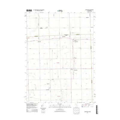
2013 Map of Assumption
USGS Topo · Published 2013About this map
Metamora and Assumption anchor this rural landscape straddling the Michigan-Ohio state line during the early twenty-first century. The map illustrates a highly organized grid of county roads and highways that connect small, established clusters like Whiteville, Lytton, and Dutch Ridge. This agricultural region is defined by the drainage patterns of Tenmile Cr and Ai Cr, which wind through the flat farmland. For those researching family history, the map provides precise locations for several local burial grounds, including the Amboy Township Cem, Peebles Cem, and the Saint Marys Catholic Cem located just west of Assumption. This 2013 data reflects the modern footprint of longstanding crossroads communities, showing how commercial operations like Beroske Farms and Greenhouse integrate with the traditional residential and spiritual centers of Fulton County.
Find a feature on this map
61 named features on this map. Tap any name to fly to it.
Don’t see what you’re looking for? This feature index may not catch every label — zoom into the map to look around manually.
Map Details
Editions of this 2013 Assumption Map
This is the sole edition of this map. No revisions or reprints were ever made.
Other maps of this area

1911 · Wauseon
USGS Topo · 1:62,500

1911 · Swanton
USGS Topo · 1:62,500

1913 · Wauseon
USGS Topo · 1:62,500

1914 · Swanton
USGS Topo · 1:62,500

1935 · Whitehouse
USGS Topo · 1:24,000

1935 · Berkey
USGS Topo · 1:24,000

1939 · Berkey
USGS Topo · 1:31,680

1939 · Blissfield
USGS Topo · 1:62,500
1940 · Whitehouse
USGS Topo · 1:31,680

1941 · Blissfield
USGS Topo · 1:62,500