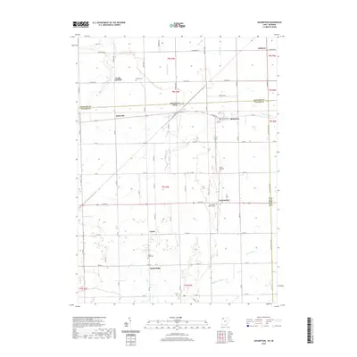
2019 Map of Assumption
USGS Topo · Published 2019About this map
Metamora and the surrounding agricultural landscapes of Fulton County define this borderland region where Ohio meets Michigan. The area is characterized by a dense network of township roads and drainage systems like Tenmile Cr and Frankfort Ditch, reflecting over a century of land management in the Maumee Lake Plain. Small settlements and historical crossroads like Assumption and Lytton serve as local anchors, while the presence of numerous burial grounds, including Saint Marys Catholic Cem and Amboy Township Cem, provides significant touchpoints for genealogical research. The transition from the rural village of Metamora south toward Dutch Ridge reveals a landscape meticulously organized by the Public Land Survey System, with sectional lines still dictating the path of modern thoroughfares like Us Rte 20.
Find a feature on this map
47 named features on this map. Tap any name to fly to it.
Don’t see what you’re looking for? This feature index may not catch every label — zoom into the map to look around manually.
Map Details
Editions of this 2019 Assumption Map
This is the sole edition of this map. No revisions or reprints were ever made.
Other maps of this area

1911 · Wauseon
USGS Topo · 1:62,500

1911 · Swanton
USGS Topo · 1:62,500

1913 · Wauseon
USGS Topo · 1:62,500

1914 · Swanton
USGS Topo · 1:62,500

1935 · Whitehouse
USGS Topo · 1:24,000

1935 · Berkey
USGS Topo · 1:24,000

1939 · Berkey
USGS Topo · 1:31,680

1939 · Blissfield
USGS Topo · 1:62,500
1940 · Whitehouse
USGS Topo · 1:31,680

1941 · Blissfield
USGS Topo · 1:62,500