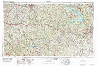
1953 Map of Athens
USGS Topo · Published 1974About this map
Athens and Augusta anchor this mid-century portrait of Central and Eastern Georgia, showing a landscape defined by expansive river systems and the emerging industrial infrastructure of the post-war South. The massive Clark Hill Reservoir dominates the eastern border along the Savannah River, illustrating the scale of water management and recreation development that reshaped the region. Significant federal land holdings are prominent, including the Oconee National Forest and Piedmont National Wildlife Refuge, which contrast with the dense network of small agricultural and railway towns like Social Circle, Union Point, and Eatonton.
Find a feature on this map
75 named features on this map. Tap any name to fly to it.
Don’t see what you’re looking for? This feature index may not catch every label — zoom into the map to look around manually.
Map Details
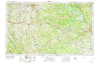
Editions of this 1953 Athens Map
3 editions found

Other maps of this area

1888 · Atlanta
USGS Topo · 1:125,000

1890 · Suwanee
USGS Topo · 1:125,000

1890 · Atlanta
USGS Topo · 1:125,000

1891 · Gainesville
USGS Topo · 1:125,000

1891 · Carnesville
USGS Topo · 1:125,000

1892 · Mc Cormick
USGS Topo · 1:125,000

1892 · Abbeville
USGS Topo · 1:125,000

1892 · Atlanta
USGS Topo · 1:125,000

1893 · Elberton
USGS Topo · 1:125,000

1894 · Suwanee
USGS Topo · 1:125,000