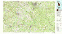
1980 Map of Athens
USGS Topo · Published 1981About this map
The University of Georgia campus and the historic Oconee Hill Cemetery anchor the city of Athens, serving as the primary hub for this expansive 1980 survey. The landscape is defined by the convergence of major river systems, including the Oconee River, Appalachee River, and Alcovy River, which shaped the early development of North Georgia. The regional economy is traced through the established rail networks of the Seaboard Coast Line, Georgia Railroad, and Central of Georgia, which connect surrounding county seats such as Monroe, Lawrenceville, and Madison.
Find a feature on this map
195 named features on this map. Tap any name to fly to it.
Don’t see what you’re looking for? This feature index may not catch every label — zoom into the map to look around manually.
Map Details
Editions of this 1980 Athens Map
2 editions found
Other maps of this area

1888 · Atlanta
USGS Topo · 1:125,000

1890 · Suwanee
USGS Topo · 1:125,000

1890 · Atlanta
USGS Topo · 1:125,000

1891 · Gainesville
USGS Topo · 1:125,000

1891 · Carnesville
USGS Topo · 1:125,000

1892 · Atlanta
USGS Topo · 1:125,000

1893 · Elberton
USGS Topo · 1:125,000

1894 · Suwanee
USGS Topo · 1:125,000

1895 · Atlanta
USGS Topo · 1:125,000

1896 · Monroe
USGS Topo · 1:125,000