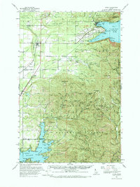
1961 Map of Athol
USGS Topo · Published 1973About this map
Athol stands at the western edge of this early 1960s survey, situated along the Spokane International Railroad where the timber-rich landscape transitions toward the southern reaches of Lake Pend Oreille. The map reveals a post-war landscape where military history and resource extraction overlap, notably at the Naval Reservation near Scenic Bay, which includes a Naval Laboratory and Sewage Disposal facilities. Inland, the terrain is marked by industrial remnants such as the Northern Pacific Railroad Grade and an International Pipeline cutting through the Kaniksu National Forest.
Find a feature on this map
117 named features on this map. Tap any name to fly to it.
Don’t see what you’re looking for? This feature index may not catch every label — zoom into the map to look around manually.
Map Details
Editions of this 1961 Athol Map
3 editions found

Other maps of this area

1901 · Sandpoint
USGS Topo · 1:125,000

1903 · Rathdrum
USGS Topo · 1:125,000

1909 · Cataldo
USGS Topo · 1:125,000

1911 · Cataldo
USGS Topo · 1:125,000

1911 · Priest Lake
USGS Topo · 1:250,000

1911 · Sandpoint
USGS Topo · 1:125,000

1913 · Priest Lake
USGS Topo · 1:250,000

1949 · Packsaddle Mtn
USGS Topo · 1:62,500

1951 · Packsaddle Mtn
USGS Topo · 1:62,500

1955 · Spokane
USGS Topo · 1:250,000