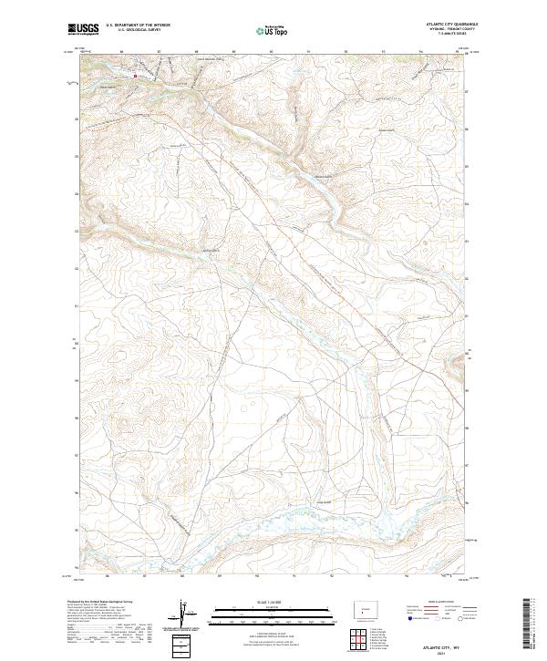
2021 Map of Atlantic City
USGS Topo · Published 2021About this map
Rock Cr and its many tributaries, including Atlantic Gulch and Beer Garden Gulch, carve through this high-elevation landscape where early western migrations and modern recreational paths converge. The settlement of Atlantic City is detailed at the street level, showing Main St, Carpenter St, and Anthony Gulch. The map captures a complex network of historic transit routes, from the pioneering Oregon Trl and the Point Of Rocks South Pass Stag Rd to the contemporary Continental Divide National Scenic Trl. To the south, the Sweetwater River flows through the terrain alongside man-made water systems like Beaver Dam Ditch and Burnt Ranch Ditch. This geography illustrates the vital role of water management and established trails in the development of the Wyoming territory, serving as a corridor for both nineteenth-century gold seekers and modern travelers.
Find a feature on this map
45 named features on this map. Tap any name to fly to it.
Don’t see what you’re looking for? This feature index may not catch every label — zoom into the map to look around manually.
Map Details
Editions of this 2021 Atlantic City Map
This is the sole edition of this map. No revisions or reprints were ever made.
Other maps of this area

1953 · Gravel Spring
USGS Topo · 1:24,000

1953 · Radium Springs
USGS Topo · 1:24,000

1953 · Atlantic City
USGS Topo · 1:24,000

1953 · Louis Lake
USGS Topo · 1:24,000

1953 · South Pass City
USGS Topo · 1:24,000

1954 · Miners Delight
USGS Topo · 1:24,000

1955 · Lander
USGS Topo · 1:250,000

1958 · Lander
USGS Topo · 1:250,000

1958 · Circle Bar Lake
USGS Topo · 1:24,000

1958 · Dickie Springs
USGS Topo · 1:24,000