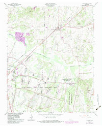
1966 Map of Atwood
USGS Topo · Published 1983About this map
Atwood and the expansive Milan Arsenal and Wildlife Management Area dominate this landscape during the mid-1960s. The map illustrates a region transitioning from rural agriculture to specialized government land use, with the University of Tennessee Milan Agricultural Experimental Station and the Tennessee National Guard Milan Reservation occupying significant acreage. The Seaboard railroad cuts a sharp diagonal across the terrain, passing through the heart of Atwood and near the MTA Jr High Sch.
Find a feature on this map
48 named features on this map. Tap any name to fly to it.
Don’t see what you’re looking for? This feature index may not catch every label — zoom into the map to look around manually.
Map Details
Editions of this 1966 Atwood Map
4 editions found
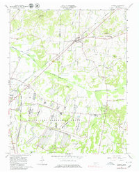
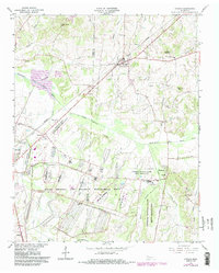
Other maps of this area

1952 · Milan
USGS Topo · 1:24,000

1954 · Bradford
USGS Topo · 1:24,000

1956 · Dyersburg
USGS Topo · 1:250,000

1956 · Blytheville
USGS Topo · 1:250,000

1959 · Medina
USGS Topo · 1:24,000

1959 · Blytheville
USGS Topo · 1:250,000

1966 · Spring Creek
USGS Topo · 1:24,000

1966 · Mc Lemoresville
USGS Topo · 1:24,000

1966 · Atwood
USGS Topo · 1:24,000

1966 · Trezevant West
USGS Topo · 1:24,000