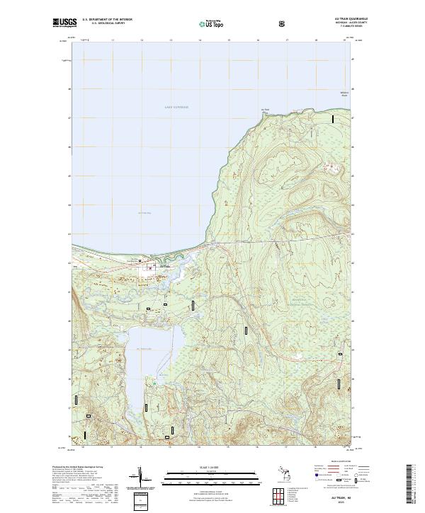
2023 Map of Au Train
USGS Topo · Published 2023About this map
Au Train sits at the northern edge of the Upper Peninsula, where the Au Train River meets the waters of Au Train Bay. This modern survey of the Lake Superior shoreline reveals a landscape defined by water and recreational trails. The settlement itself is anchored by the Au Train Township Cem, while the surrounding terrain is protected within the Hiawatha National Forest.
Find a feature on this map
29 named features on this map. Tap any name to fly to it.
Don’t see what you’re looking for? This feature index may not catch every label — zoom into the map to look around manually.
Map Details
Editions of this 2023 Au Train Map
This is the sole edition of this map. No revisions or reprints were ever made.
Other maps of this area

1958 · Munising
USGS Topo · 1:62,500

1958 · Au Train
USGS Topo · 1:62,500

1958 · Wood Island
USGS Topo · 1:62,500

1958 · Marquette
USGS Topo · 1:250,000

1960 · Marquette
USGS Topo · 1:250,000

1961 · Marquette
USGS Topo · 1:250,000

1968 · Marquette
USGS Topo · 1:250,000

1983 · Munising
USGS Topo · 1:100,000
1984 · Au Sable Point
USGS Topo · 1:100,000
1985 · Munising
USGS Topo · 1:24,000