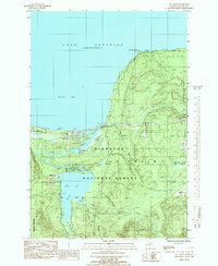
1985 Map of Au Train
USGS Topo · Published 1985About this map
Au Train sits at the northern edge of the Hiawatha National Forest, where the waters of the Au Train River meet the sandy shores of Au Train Bay on Lake Superior. This mid-1980s provisional survey shows a landscape defined by the movement between fresh inland waters and the Great Lakes coast. The settlement itself is clustered near the river's mouth, with the Au Train Township Cem and a Road Side Park marking the transition from the lakefront to the dense woods.
Find a feature on this map
26 named features on this map. Tap any name to fly to it.
Don’t see what you’re looking for? This feature index may not catch every label — zoom into the map to look around manually.
Map Details
Editions of this 1985 Au Train Map
This is the sole edition of this map. No revisions or reprints were ever made.
Other maps of this area

1958 · Munising
USGS Topo · 1:62,500

1958 · Au Train
USGS Topo · 1:62,500

1958 · Wood Island
USGS Topo · 1:62,500

1958 · Marquette
USGS Topo · 1:250,000

1960 · Marquette
USGS Topo · 1:250,000

1961 · Marquette
USGS Topo · 1:250,000

1968 · Marquette
USGS Topo · 1:250,000

1983 · Munising
USGS Topo · 1:100,000
1984 · Au Sable Point
USGS Topo · 1:100,000
1985 · Munising
USGS Topo · 1:24,000