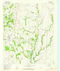
1960 Map of Aubrey
USGS Topo · Published 1974About this map
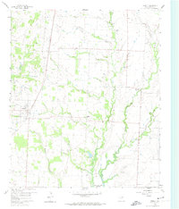
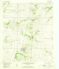
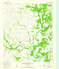
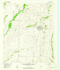
Aubrey serves as the primary hub of this north-central Texas landscape, situated along the Texas and Pacific railroad line. The map illustrates a transitional period for the area, where rural agriculture is clearly defined by the intricate network of fence and field lines recorded from late-1950s aerial photography. Small rural gatherings are anchored by locations like Spring Hill and Mustang, while the northern reaches of the Garza-Little Elm Reservoir begin to transform the southern drainage patterns. Water is central to the topography here, with the winding paths of Pecan Creek, Mustang Creek, and Little Elm Creek cutting through the terrain. Evidence of early community life is preserved in labels for a Cem and a Community House, offering genealogists and local historians specific points of interest before more modern suburban expansion altered the Denton County countryside.
Find a feature on this map
16 named features on this map. Tap any name to fly to it.
Don’t see what you’re looking for? This feature index may not catch every label — zoom into the map to look around manually.
Map Details
Editions of this 1960 Aubrey Map
2 editions found
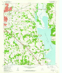
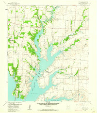
Other maps of this area

1929 · Frisco
USGS Topo · 1:62,500

1954 · Sherman
USGS Topo · 1:250,000

1958 · Sherman
USGS Topo · 1:250,000
1960 · Frisco
USGS Topo · 1:24,000
1960 · Green Valley
USGS Topo · 1:24,000
1960 · Celina
USGS Topo · 1:24,000
1960 · Aubrey
USGS Topo · 1:24,000
1960 · Denton East
USGS Topo · 1:24,000
1960 · Little Elm
USGS Topo · 1:24,000
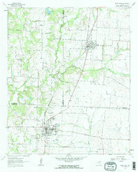
1961 · Pilot Point
USGS Topo · 1:24,000