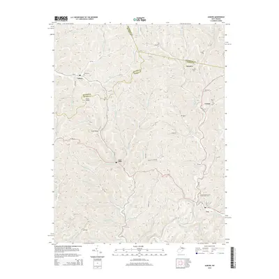
2014 Map of Auburn
USGS Topo · Published 2014About this map
Auburn and Troy anchor this detailed study of the Appalachian plateau along the border of Ritchie, Gilmer, and Doddridge counties. The landscape is defined by an intricate network of narrow ridges and winding hollows, such as Brake Hollow, which dictate the placement of early settlements and roads. Small communities like Coxs Mills and Spurgeon are situated at key drainage confluences, reflecting a settlement pattern deeply tied to the local watercourses. Genealogists will find significant value in the numerous family and fraternal burial sites documented here, including the Lowther Cem, Brannon Cem, and the notable Troy-International Order of Odd Fellows Cem. The map traces the winding paths of Leading Creek and Bone Cr, illustrating how the region's topography has preserved a traditional West Virginia rural character well into the twenty-first century.
Find a feature on this map
76 named features on this map. Tap any name to fly to it.
Don’t see what you’re looking for? This feature index may not catch every label — zoom into the map to look around manually.
Map Details
Editions of this 2014 Auburn Map
This is the sole edition of this map. No revisions or reprints were ever made.
Other maps of this area

1893 · Sutton
USGS Topo · 1:125,000

1904 · Vadis
USGS Topo · 1:62,500

1906 · Holbrook
USGS Topo · 1:62,500

1906 · Glenville
USGS Topo · 1:62,500

1906 · Burnsville
USGS Topo · 1:62,500

1924 · Holbrook
USGS Topo · 1:62,500

1925 · Glenville
USGS Topo · 1:62,500

1925 · Burnsville
USGS Topo · 1:62,500

1925 · Vadis
USGS Topo · 1:62,500

1926 · Holbrook
USGS Topo · 1:62,500