
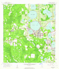
1944 Map of Auburndale
USGS Topo · Published 1944About this map
Auburndale sits at the heart of this mid-century Florida landscape, defined by an intricate network of citrus groves and more than a dozen named lakes. The town serves as a busy junction for the Atlantic Coast Line and Seaboard Air Line railroads, which cut across a terrain dominated by water bodies like Ariana Lake and Lake Van. The presence of Phosphate Mines in the southwestern corner near Saddle Creek points to the region's industrial foundations beyond agriculture.
Find a feature on this map
48 named features on this map. Tap any name to fly to it.
Don’t see what you’re looking for? This feature index may not catch every label — zoom into the map to look around manually.
Map Details
Editions of this 1944 Auburndale Map
2 editions found
Other maps of this area

1944 · Providence
USGS Topo · 1:31,680

1944 · Polk City
USGS Topo · 1:31,680

1944 · Lakeland
USGS Topo · 1:31,680

1949 · Mulberry
USGS Topo · 1:24,000

1949 · Bartow
USGS Topo · 1:24,000

1950 · Mulberry
USGS Topo · 1:24,000

1950 · Bartow
USGS Topo · 1:24,000

1955 · Eloise
USGS Topo · 1:24,000

1955 · Orlando
USGS Topo · 1:250,000

1956 · Fort Pierce
USGS Topo · 1:250,000