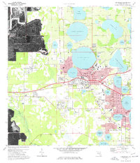
1975 Map of Auburndale
USGS Topo · Published 1977About this map
Auburndale sits at the heart of this mid-1970s landscape, defined by a dense network of freshwater lakes and the industrial infrastructure of the Seaboard Coast Line railroad. The map documents the city's growth toward Winter Haven and Inwood, capturing a period of transition where traditional citrus-belt terrain met modern recreation and industry. Notable landmarks like the Browns Seaplane Base on Lake Jessie and the S Gilbert Airport highlight the region's aviation history, while the Winter Haven Motor Speedway and a Drive-in Theater represent the era's local entertainment hubs.
Find a feature on this map
71 named features on this map. Tap any name to fly to it.
Don’t see what you’re looking for? This feature index may not catch every label — zoom into the map to look around manually.
Map Details
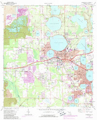
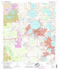
Editions of this 1975 Auburndale Map
3 editions found
Other maps of this area

1944 · Providence
USGS Topo · 1:31,680

1944 · Polk City
USGS Topo · 1:31,680

1944 · Lakeland
USGS Topo · 1:31,680

1944 · Auburndale
USGS Topo · 1:31,680

1949 · Mulberry
USGS Topo · 1:24,000

1949 · Bartow
USGS Topo · 1:24,000

1950 · Mulberry
USGS Topo · 1:24,000

1950 · Bartow
USGS Topo · 1:24,000

1955 · Eloise
USGS Topo · 1:24,000

1955 · Orlando
USGS Topo · 1:250,000